Large Scale Wind Structures
by Andrew Hall
In previous articles, we established a link between the winds of Jupiter and landforms on Earth. In primordial times, Earth’s weather was like Jupiter’s, with raging plasma whirlwinds and segregated electric jet streams that attained supersonic speeds. Close examination of mountains and other landforms shows clear evidence of wind-blown deposition that layered the land, supersonic shock waves that shaped mountain flanks, massive lightning discharges that welded rock, and plasma vortexes that blow-torched the land.
Jupiter’s winds are the result of capacitance between double layers in the atmosphere and the plasma sheath at the planet’s surface. We don’t know what the surface of Jupiter is, but it doesn’t matter — it still forms a plasma sheath — a double layer at the interface between crust and atmosphere. Electric circuits form the winds; by capacitance, inductance and magnetic fields. Surface and atmosphere are coupled by capacitance, and ongoing release of energy from Jupiter’s interior is what stirs the winds.
On Earth, dust particles, aerosols and the water cycle — evaporation, condensation, ice and rain — are the charge carriers or the “wires” of the circuit. On Jupiter, it also includes ammonia and other species.
Regardless of the difference in chemistry between Earth and Jupiter, charge diffusion in Nature follows patterns. A lightning bolt on Jupiter is like a lightning bolt on Earth. It is a discharge between plasma layers that takes a fractal path as ionized filaments react in feedback with the magnetic field the current produces.
Fractal forms are generated by this feedback loop in any process of charge diffusion. They are not restricted to the Lichtenburg pattern of a lightning bolt but are evident in the helical path of field-aligned Birkeland currents, the geometry of electromagnetic fields, and drift currents reacting to far-field potentials.
So it should be no surprise at all to find the same fractal patterns in Jupiter’s winds as we find on Earth’s landscape if indeed the landscape was formed by similar winds.
Bootprints
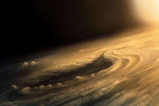
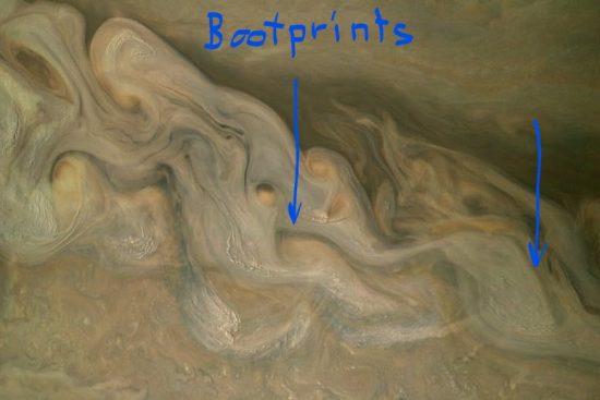
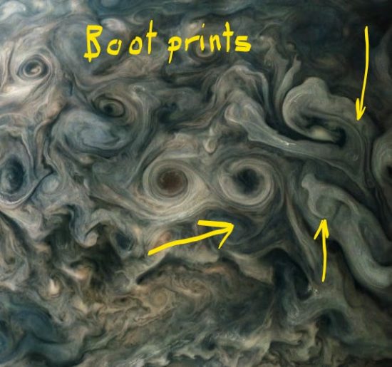
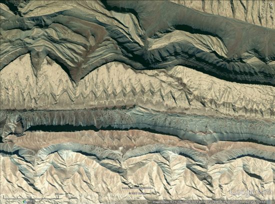
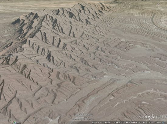
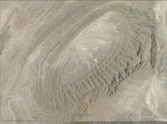
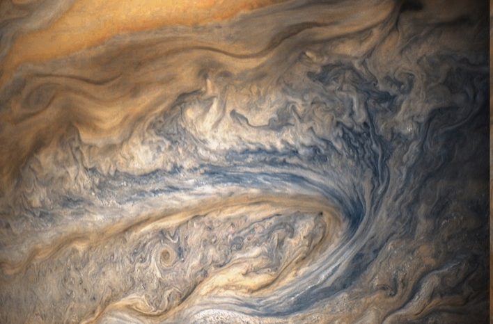
One spade-shaped feature is almost ubiquitous in Jupiter’s turbulence: the ‘bootprint’. On Jupiter, the bootprint is the down-drafting eye of a cyclone being pinched in the turbulent flow of competing winds. Like a hurricane, it is fed by billowing thunderstorms surrounding a whirlpool, which together forms a piece of a circuit — a ring current between the atmosphere and ground. The shape at the cloud tops is carried to the surface and reflected there because the structure is a fractal, rotating filament of current reaching the surface.
When Earth’s weather raged like Jupiter’s, Earth was in its formative age. The continents were being built, as layer upon layer of dust accumulated on a foundation of volcanic flows. Turbulent cyclones in Earth’s atmosphere produced bootprints identical in form to the bootprints on Jupiter. Bootprints on Earth are literally, the footprints of storms.
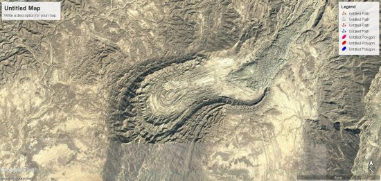
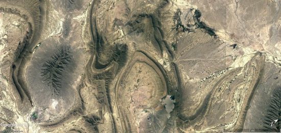
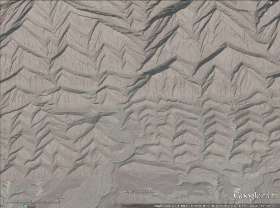
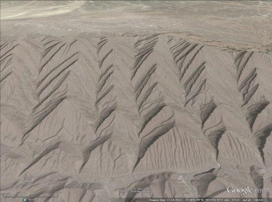
Bootprints on Earth are clear evidence of electric formation because they display exactly what is expected in fine detail. The bootprint is the consequence of a down bursting wind — a hot, ionized, super-sonic, dust-laden wind aimed at the ground like a blow-torch.
The mountain rim is the pattern of a standing shock wave. The repeating triangular layers on the inner flanks are impressed there by harmonic shock reflections, which channelled the wind at the boundary layer, and trapped dust in the low-pressure zone of the triangular wave-forms.
Shock waves produce triangular patterns of expansion and compression when a supersonic wind is deflected — like when it hits solid land.
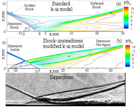
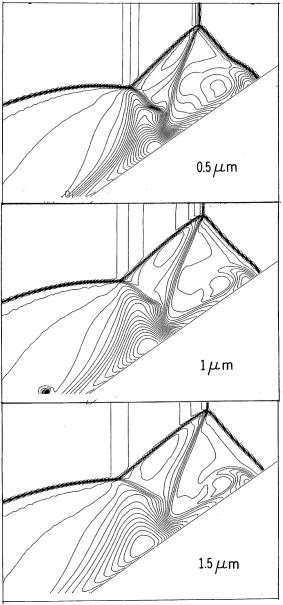
Just ahead of where a shock wave reflects, a low-pressure region forms called the “Separation Bubble”. The separation bubble is in the shape of a tetrahedron, with a triangular face perpendicular to the wind at the same angle as the shock wave reflection — called the Mach angle.
As dust-laden, ionized winds pass through the separation bubble, this low-pressure region collects dust like a vacuum cleaner and piles it in triangular layers. Therefore, the rims or mountains surrounding a bootprint crater display these triangular layers.
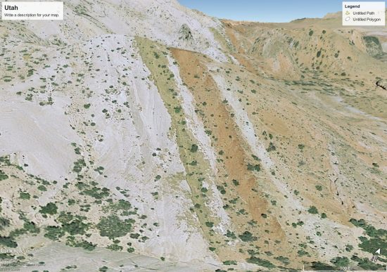
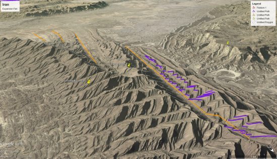
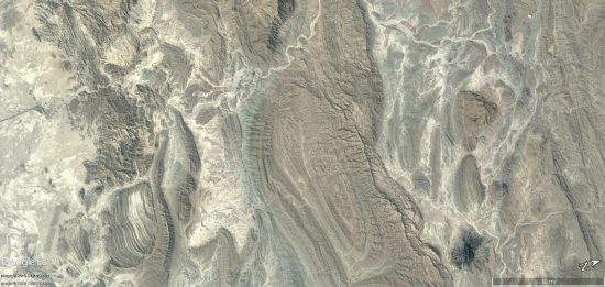
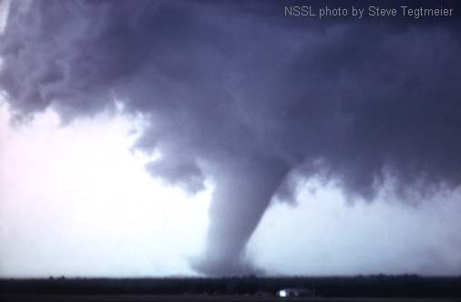
If a downburst wind strikes at an angle, rotates, or its mass flow is biased to one side, it will affect the shape of the crater it forms. Bootprints are often accompanied by a feature called a Prandtl-Meyer expansion fan. It is a series of standing shock waves that form linear rays of compression and rarefaction where the wind strikes and reflects off an object. This pattern implies the bootprint is the result of an obliquely striking wind that rotated.
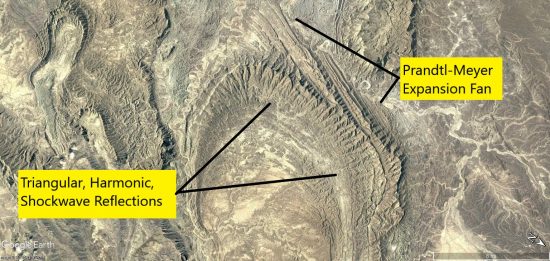
If you have ever watched tornadoes, you probably noticed they are rarely perfectly vertical. They contact the ground at an angle, and the rotating wind is lifted to one side and grinds against the ground on the opposite side. That is precisely what has happened here to produce a bootprint crater with an expansion fan.
This single example is proof of my theory. Anyone with a supersonic wind tunnel can produce a Prandtl-Meyer expansion fan, tetrahedron shaped separation bubbles and triangular harmonic reflections — it’s been done countless times. But show a way to produce all of these together in a large scale coherent form by tectonic uplift, seismic vibration, slip faulting, erosion, or any other conventional geophysical means. Can’t be done. It is uniquely the result of supersonic shock. Nature provides rational, obvious proof, without need for computers or numeric models.
The pattern is not vague, like Jesus on a piece of toast. It is confirmed in every detail. The correlation is not only visual similarity but also causation — vertical high-speed winds, electrically charged and shaped by electromagnetic fields. Proof of the winds of Jupiter are in NASA’s data; proof of the ground effects on Earth is under our feet, and in decades of applied science in supersonic shock wave behavior. Proper interpretation of data and some wind tunnel testing would put the issue to bed.
But maybe I can do that with this next example.
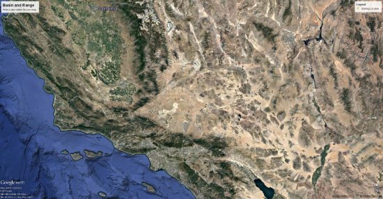
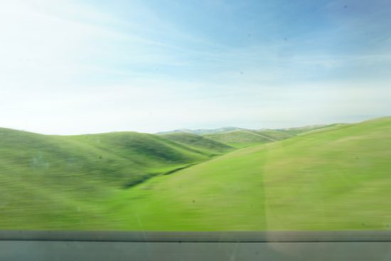
California
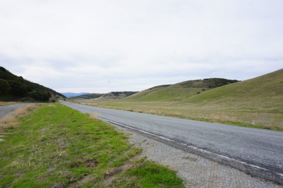
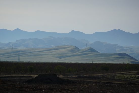
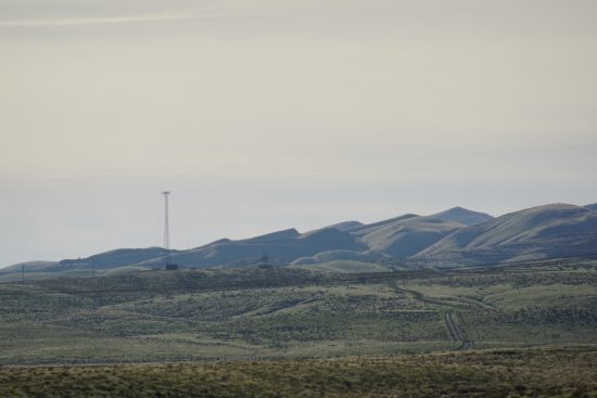
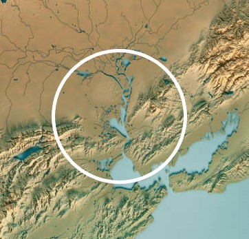
California’s most prominent feature is the San Joaquin Valley and its ring of mountains, including the imposing Sierra Nevada mountain arc and coastal ranges. Inside this bathtub, the floor of the valley is a long, flat plain, which at one time was an ancient sea bed.
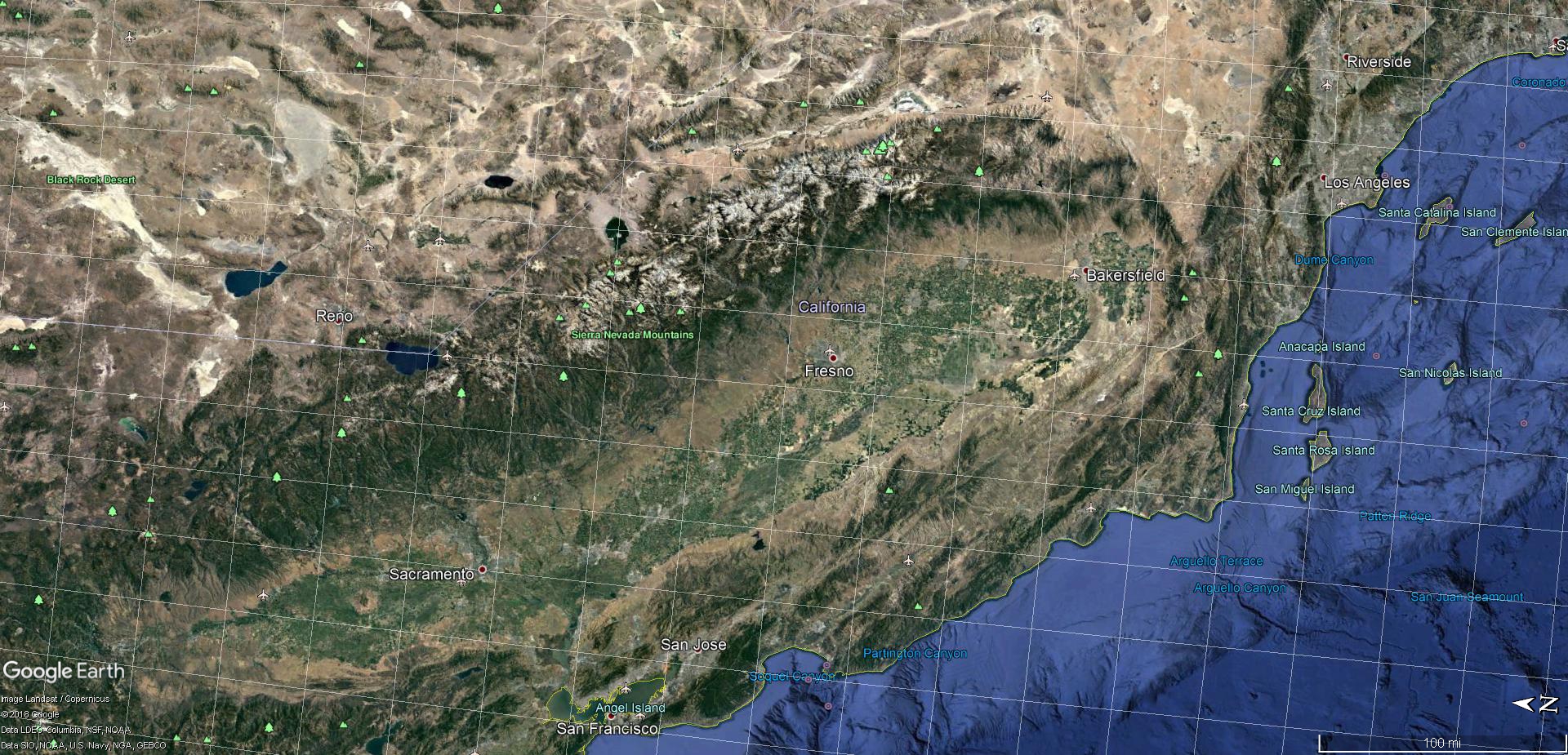
It was created by a storm like this on Jupiter. So, let’s look at some amazing details.
This image shows four specific areas we’ll discuss.
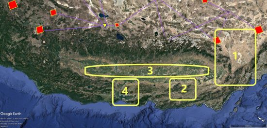
Area 1 — Mojave Desert
This almost perfect triangular plain of high desert is demarcated by the straight line of the Tehachapi mountains to the north, and the straight line of San Gabriel mountains to the south, which also, by the way, aligns with the San Andreas Fault.
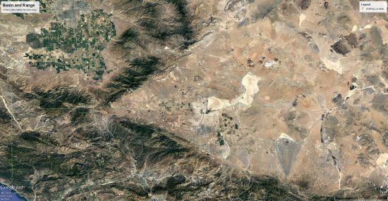
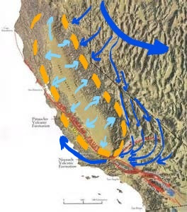
It correlates to the region of low-level winds, tinted blue, at the cusp of the oval storm rotation on Jupiter. These winds are sinking winds — that is they are pressing against the ground in a Venturi effect as they speed around the cusp of the storm. The yellow-brown ring of the storm is a rising wind, forming what is essentially a continuous ring of thunderstorms. The sharp triangular demarcation between desert and mountain is the shear zone where shock waves formed between the low-level horizontal winds and the rising winds of the rotating storm.
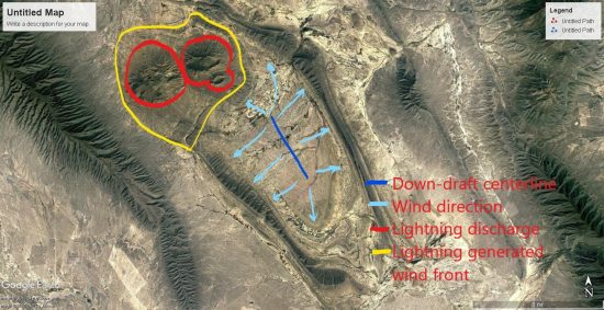
As these winds rounded the corner into the Venturi, they accelerated, gouging the deep Owens, Saline, Amargosa, and Death Valleys. Separating these valleys rise eleven thousand foot ridgelines of the Panamint, Darwin and Amorgosa ranges. They formed as sastrugi, parallel to the jet streams in low-pressure interference zones between the laminar jet streams.
Lightning in this region was imposing. A plasma intensifies in a shear zone, meaning it generates ion content due to the shearing and extreme temperature and pressure differentials. Shearing supersonic winds bounce shock waves between them, generating high current density in jet-streams that extended for thousands of miles. Lightning discharge from these plasma streams focused on the piling mountains below with the capacity of a thousand-mile long thunderstorm being continually fed new energy.
The current dumped in the strike zone didn’t simply flash a split second, here and there, but arced continuously, diffusing through the land welding granite from dust and sand. That is why the Sierras, in this southern portion of the range, have the most impressive granite structures: Yosemite, Mt. Whitney, its neighboring peaks, and the Domes. The granite of the Sierras lies atop sediments, which implies the storm(s), by either wind or tsunami, brought layers of dust long before lightning began to strike.
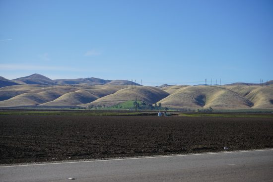
Area 2 — Coalinga
Coaling Station “A” was its original name. Coalinga, as it’s called today, is an oil patch town. The foothills that surround it are oil fields — anticlines of shallow sandstone saturated in heavy oil. Similar anticlines flank the western side of the San Joaquin Valley, from Coalinga to the end of the bathtub at Bakersfield. These anticlines compose some of the largest oilfields in North America.
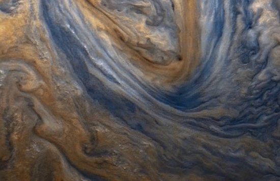
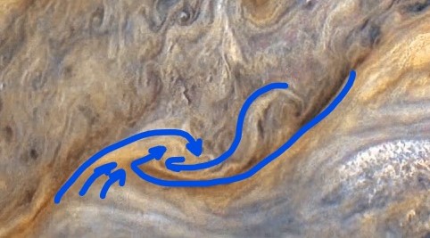
What created them was like this turbulent region in Jupiter’s clouds. The colorized image from NASA shows a crab-claw cloud structure, with high-level clouds in yellow, and low-level clouds in blue and black. There are several tornado rotations along the boundaries of opposing flows. There are also deep, dark, linear filaments.
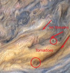
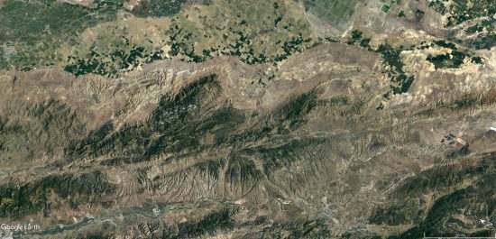

Now correlate the dark filaments with the deep cut, linear valleys near Coalinga. The dark filaments are ground-level jet streams, which are what formed these valleys by preventing dust from depositing. Follow the filament in Jupiter’s cloud and it ends in a tornado. Follow the valleys near Coalinga and they end in hills with spiral features. In other words, the filaments are jet streams hugging the ground, cutting beneath the storm clouds to feed a giant tornado.
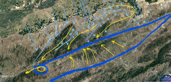
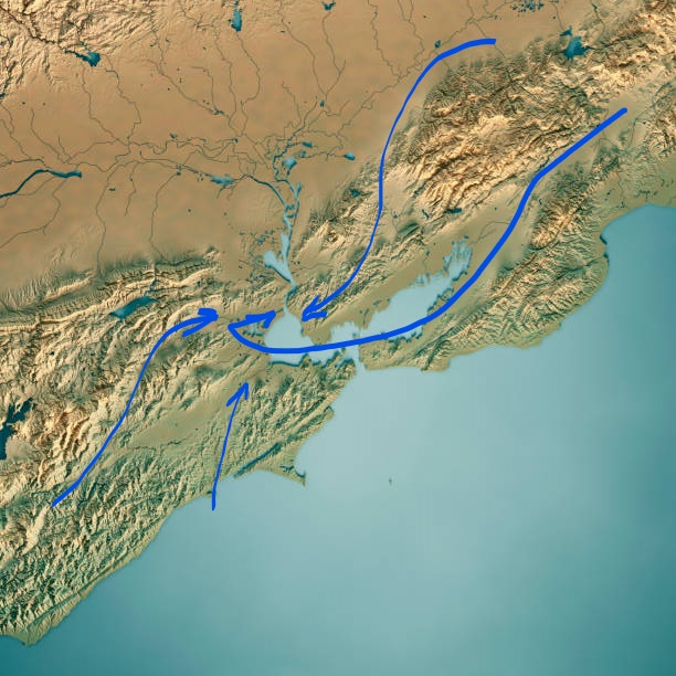
Blue lines in the wind pattern image represent ground level winds, combing across the San Joaquin Valley, and rising into thunderstorms. Yellow represents the higher level mesocyclone winds which rained dust and rock. The blue winds approach the thunderstorms orthogonally, then rise in the updraft of the storm. Dark blue lines are the tornadoes and ground-hugging jet streams.
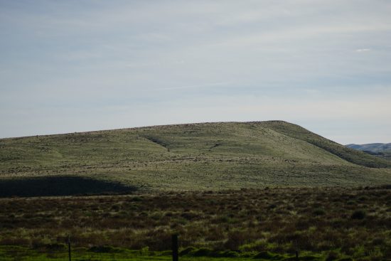
A drive through the region shows the mountains are windblown dunes that rise abruptly from the flat valley floor and display exactly the wind patterns described.
It seems chaotic — winds crisscrossing in every direction. But it’s not. The overall wind structure is called a Kelvin-Helmholtz instability. It’s a fractal pattern that happens all the time if there is wind shear.
Area 3 — San Joaquin Valley
Look inside the yellow ring of thunderstorms and see that there are dozens of small vortexes. These are tornadoes, or perhaps water spouts because the San Joaquin Valley was likely a sea at the time.
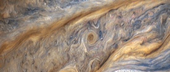
Among all the tiny whirlwinds is one giant tornado almost in the center of the storm. This feature correlates well with a circular region of the Sierra foothills at the North end of the San Joaquin Valley. If you have ever driven from Sacramento to Lake Tahoe on State Highway 50, past the town of Folsom, you have climbed the Sierra foothills that constitute this feature. A distinct swirl is evident in the hills just above (to the East) of Folsom Lake.
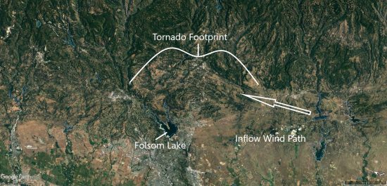
The swirl is fed by ground-level winds entering the vortex from the left (South), whereas the top level winds in Jupiter’s cloud tops flow in from below (from the West on the Earth image). This indicates differences in flow patterns between double layers due to the rotational symmetry of fractals. Fractal rotational symmetry is when a fractal shape repeats but rotated by 90, or 180 degrees. This indicates the wind clocks around ninety degrees at different layers of the storm. The same thing occurs in hurricanes and mesocyclones on Earth, even today.
Area 4 — San Francisco Bay
Here, you are literally seeing the drain in the bathtub. Follow the dark filaments in Jupiter’s clouds and they converge in a vortex.

Compare the dark filaments on Jupiter to the long, linear valleys leading to San Francisco Bay, and you see the same pattern. The dark filaments are ground-level jet streams that scoured the land, while the light-colored cloud tops are thunderstorm anvils raining charged dust to form the mountains.
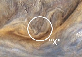
Look close at Jupiter’s clouds near the center of rotation and there is a dark “X” shaped feature. Then compare to the Sacramento Delta and you’ll see, the Delta is the top of the “X”. Again, it’s because the dark filaments are ground scouring winds, which in this case scoured the land to a depth below current sea level.
I hope these images provide unambiguous evidence of how the Earth was formed. Any one or two matching features between the clouds of Jupiter and the Earth’s landscape could be coincidence. But overlay Jupiter’s oval storm on California and all seven features depicted here match in both shape and position, and the wind patterns not only look like but explain the land features. At least they do if you apply electric circuitry, and ignore consensus science.
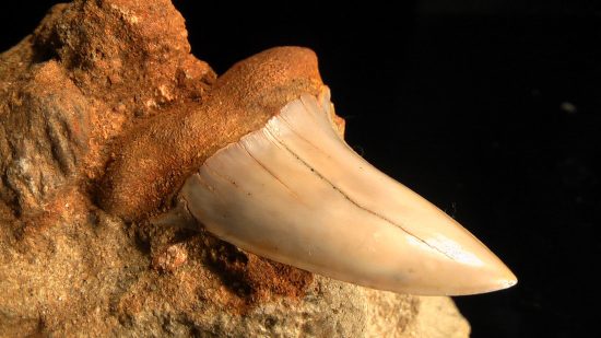
There is a host of interesting things to learn by understanding California’s true formation. For instance, a whirlwind formed hill in Kern County is full of ancient shark’s teeth fossils. These sharks date to the middle Miocene, roughly 15 million years ago by consensus chronology. I don’t trust consensus chronology, but it does place a bookmark in the fossil and geologic record. Oil sands in San Joaquin date from the Miocene and earlier, except for one shallow Pliocene sediment. The Miocene epoch that formed Shark Hill was likely the last time such a mountain building storm raged over California. But stratigraphy and the fossil record suggests there were many similar fractal storms in earlier epochs.
Additional Resources by Andrew Hall:
YouTube Playlists through 4-2022:
Andrew Hall — EU Geology and Weather
Andrew Hall — Eye of the Storm Episodes (13)
Surface Conductive Faults | Thunderblog
Arc Blast — Part One | Thunderblog
Arc Blast — Part Two | Thunderblog
Arc Blast — Part Three | Thunderblog
The Maars of Pinacate, Part One | Thunderblog
The Maars of Pinacate, Part Two | Thunderblog
Nature’s Electrode | Thunderblog
The Summer Thermopile | Thunderblog
Tornado — The Electric Model | Thunderblog
Lightning-Scarred Earth, Part 1 | Thunderblog
Lightning-Scarred Earth, Part 2 | Thunderblog
Sputtering Canyons, Part 1 | Thunderblog
Sputtering Canyons, Part 2 | Thunderblog
Sputtering Canyons, Part 3 | Thunderblog
Eye of the Storm, Part 1 | Thunderblog
Eye of the Storm, Part 2 | Thunderblog
Eye of the Storm, Part 3 | Thunderblog
Eye of the Storm, Part 4 | Thunderblog

Andrew Hall is a natural philosopher, engineer, and writer. A graduate of the University of Arizona’s Aerospace and Mechanical Engineering College, he spent thirty years in the energy industry. He has designed, consulted, managed, and directed the construction and operation of over two and a half gigawatts of power generation and transmission, including solar, gasification, and natural gas power systems. From his home in Arizona, he explores the mountains, canyons, volcanoes, and deserts of the American Southwest to understand and rewrite an interpretation of Earth’s form in its proper electrical context. Andrew was a speaker at EU2016, EU2017 and the EUUK2019 conferences. He can be reached at hallad1257@gmail.com or thedailyplasma.blog
Disclosure: The proposed theories are the sole ideas of the author, as a result of observation, experience in shock and hydrodynamic effects, and deductive reasoning. The author makes no claims that this method is the only way mountains or other geological features are created.
The ideas expressed in Thunderblogs do not necessarily express the views of T-Bolts Group Inc. or The Thunderbolts Project.