May 6, 2020
There was water on Mars–[click] there was water on Mars–[click] there was water on Mars….
The idea that there was once a wet Mars builds upon the philosophy of Martian exploration and the search for life on other planets. As most theories state, for life to exist, there must be liquid water.
The now defunct Spirit and Opportunity rovers identified regions that look like water-carved channels. Gusev crater, in particular, was suggestive of a large lake with a runoff channel. However, analysis of data from Spirit was inconclusive and no specific signs of water were present.
The Mars Science Laboratory, otherwise known as “Curiosity”, is climbing the slopes of Mount Sharp inside Gale Crater, located just southwest of Elysium Mons. The crater is over 150 kilometers in diameter, making it one of the largest on Mars. It was selected because of its central uplift known as Aeolis Mons, a layered deposit over 5500 meters high that was supposedly eroded by wind.
Curiosity is traveling along a path that follows a channel meandering up the mountain. Several deep gouges in the mountainside are presumed to be gullies formed by liquid water runoff at some time in the distant past. As mentioned, Mt. Sharp is thought to be a collection of wind-deposited sediments that were soaked by groundwater, so mission specialists are hoping that it will provide traces of biology.
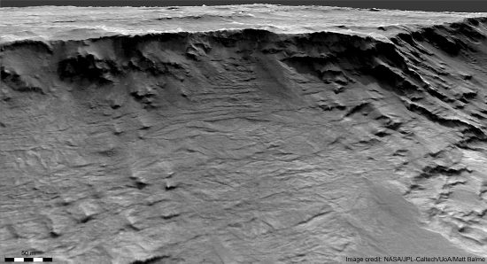
Recently, areologists examined high resolution images of the Hellas Basin region and came to the conclusion that it was eroded by water. There are many layers in what is believed to be sedimentary rocks that were deposited by water eons ago.
According to Dr. Joel Davis, a postdoctoral researcher at the Natural History Museum:
“We’ve never seen an outcrop with this amount of detail on it that we can definitely say is so old. This is one more piece of the puzzle in the search for ancient life on Mars, providing novel insight into just how much water occupied these ancient landscapes.”
Mt. Sharp’s summit appear to indicate hydrological features, as well. The HiRise satellite, celebrating its 14th year in Mars orbit, is equipped with a half-meter telescope able to resolve objects as small as 30 centimeters from 300 kilometers in orbit. A recent data analysis shows “box work” structures on top of Mt. Sharp that seem indicative of “potholes”. On Earth, potholes form on top of large boulders or on the peaks of hills and mountains. They often occur where rainwater settles in cracks and low spots. Over eons of time, those small disconformities in the rock are said to grow, sometimes into bowl-shaped lakes.
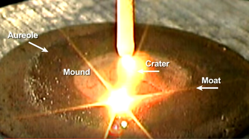
However, water is not the only force that can split rocks, carve basins, erode channels and sculpt mountains. Many Pictures of the Day argue that if the environment on Mars was ever conducive to flowing water, those conditions no longer exist because of planet-wide electrical discharges. Any water or organic material was obliterated by catastrophic lightning bolts. Whatever the source (perhaps charged, planet-sized objects), underground currents of electricity blasted out gigantic chasms in the Martian surface. X-rays and gamma-rays, along with thermal energy and explosive shockwaves, would be enough to disintegrate any organism.
As these pages point out, each of the planets took part in several catastrophic events in the not-so-distant past. Mars is often described by planetary scientists as “mysterious” or “puzzling”. The reason for their confusion is one of reverse application. Earth should not be used as a de facto model for other places in the Solar System.
Stephen Smith
The Thunderbolts Picture of the Day is generously supported by the Mainwaring Archive Foundation.


