|
||||||||

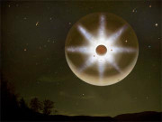
picture of the day |
chronological archive subject archive |
||
|
|
||||||||||||||||||||||||||||||||||||||||||||||||||||||||||||||||||||||||||||||||||||||||

|
|
|
|
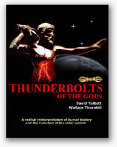
Authors David Talbott and Wallace
Thornhill introduce the reader to an age of planetary instability
and earthshaking electrical events in ancient times. If their
hypothesis is correct, it could not fail to alter many paths of
scientific investigation.
More info |
Professor
of engineering Donald Scott systematically unravels the myths of the
"Big Bang" cosmology, and he does so without resorting to black
holes, dark matter, dark energy, neutron stars, magnetic
"reconnection", or any other fictions needed to prop up a failed
theory. More info |
In
language designed for scientists and non-scientists alike, authors
Wallace Thornhill and David Talbott show that even the greatest
surprises of the space age are predictable patterns in an electric
universe. More info |
|
Disclaimer
The opinions expressed in the Thunderbolts Picture Of the Day are those of the authors of the material, and do not necessarily reflect the views of the Thunderbolts Project. The linking to material off-site in no way endorses such material and the Thunderbolts Project has no control of nor takes any responsibility for any content on linked sites. |
|
|
|
|
| EXECUTIVE EDITORS: | David Talbott, Wallace Thornhill |
| MANAGING EDITOR: | Stephen Smith |
| CONTRIBUTING EDITORS: |
Michael Armstrong, Dwardu Cardona,
Ev Cochrane, C.J. Ransom, Don Scott, Rens van der Sluijs, Ian Tresman, Tom Wilson |
| WEBMASTER: | Brian Talbott |
|
© Copyright 2010: thunderbolts.info |
|
| [ top ] |
|
home • picture of the day • thunderblogs • multimedia • resources • forum • updates • contact us • support us |