And now this (maybe).
Could the images below be linked to those forts and the Cursus or is it to small for a Cursus? Have you visited these? Looking at these then led to banjo enclosures? Are they the same thing?
Maiden Castle Aerial image
http://www.brigantesnation.com/SiteRese ... eReeth.htm
A couple more photos on this site and other research notes
Maiden Castle
Maiden Castle 110m Stone walls entranceThis is one of the most unusual forts in the British Isles, it combines a slightly odd but otherwise ordinary hill fort of the Iron Age period with a unique stone entrance corridor. The corridor was originally some 6-8m wide, lined with an unusual wall, it was completely parallel, very long, and tapered to a very low height.
The wall of the corridor has largely collapsed but in places the original dry stone walling still persists. The wall can be seen to 'taper' as fewer and fewer stones were used in its building the further away it gets from the fort. Originally the wall must have started at a height of .5m or so and rose to perhaps 4m by the time it reached and joined the fort. The southern wall was not as big but followed the shaped of the north wall.

"...Maiden Castle at Grinton in Swaledale, is a curious place with a roughly circular bank and ditch approached from the east by a stone avenue. There are round barrows in the vicinity, and although the ditch lies outside the bank, it seems very probable that Maiden Castle is not a fort but some kind of sacred enclosure or meeting place"
Jacquetta Hawkes, A Guide To The Prehistoric And Roman Monuments In England And Wales. Pub. 1978 Abacus
Banjo Enclosures
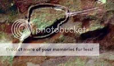
Wattles Hill banjo enclosure

http://en.wikipedia.org/wiki/Banjo_enclosure
In archaeology, Banjo enclosure is the name given to a type of archaeological feature of the British middle Iron Age. The are so named because in plan they consist of a small round area with a long entrance track leading inwards from one direction. This gives them the appearance in plan of frying pans or banjos. The enclosure is defined by a low bank and ditch. The earthworks at the end of the track are sometimes turned outwards, creating a funnel effect. They used to be thought of as small farming settlements occupied between around 400 and 100 BC, however due to the lack of finds relating to settlements they are thought to probably be a seasonal ritual centre with feasting occurring.
Wattles Hill banjo enclosure - the thing about this particular banjo enclosure is that can I spot 2 circles, one at each end? Or is the bottom one to do with the line going off to the right? Not been to the site so not able to confirm.