The proof of an ice age is based on the interpretation of the evidence supposedly left behind. Polished bedrock, sand and gravel piles, glacial valleys, out of place boulders that must have been pushed hundreds of miles from their origins. But if these features could be explained by electrical and plasma forces, might it be that the ice ages never existed?
A couple of explanation pages:
Ice age
http://en.wikipedia.org/wiki/Ice_age#Ev ... r_ice_ages
How the Ice Age Worked
http://geography.howstuffworks.com/term ... e-age1.htm
There are other sites that explain why an ice age is believed to have existed, but could other mechanisms offer a plausible explanation? Just wondering what others may think, as my recent field trips to coastal and mountainous locations on Southern Vancouver Island have left me with some serious doubts about the Standard Model of Geology.
Questioning the Ice Ages
-
GaryN

- Posts: 2668
- Joined: Tue Apr 01, 2008 8:18 pm
- Location: Sooke, BC, Canada
Questioning the Ice Ages
In order to change an existing paradigm you do not struggle to try and change the problematic model. You create a new model and make the old one obsolete. -Buckminster Fuller
-
PersianPaladin

- Posts: 668
- Joined: Sat Jan 15, 2011 8:38 am
- Location: Turkey
Re: Questioning the Ice Ages
Hmm..
What are your thoughts about the way they reconstruct past solar activity to create estimations of ice-ages?
What are your thoughts about the way they reconstruct past solar activity to create estimations of ice-ages?
-
moses
- Posts: 1111
- Joined: Wed Mar 19, 2008 3:18 pm
- Location: Adelaide
- Contact:
Re: Questioning the Ice Ages
There are other sites that explain why an ice age is believed to have existed, but could other mechanisms offer a plausible explanation?
GaryN
Whereas some of the glacial gravel and boulders could be explained by electrical explanations, it looks certain that there was ice over much of North America not long ago, and also that the ice advanced and retreated at least a few times.
My mechanism to explain this is that before the ice ages the Earth had no ice at all, and then a great deal of ice was electrically deposited. This ice was electrically held in space in water/ice bridges before the depositing event. After this the Earth went into an elliptical orbit around the Sun which caused alternating very cold and very hot conditions. The evaporation supplied the water to produce the advance of the ice as the Earth moved away from the Sun, and of course the heat melted the ice as the Earth moved near the Sun.
Thus the obvious outcome of a disturbance in orbit - an elliptical orbit, provides the outcome of advancing and retreating ice.
Mo
-
seasmith
- Posts: 2815
- Joined: Thu Mar 27, 2008 6:59 pm
Re: Questioning the Ice Ages
as my recent field trips to coastal and mountainous locations on Southern Vancouver Island have left me with some serious doubts...
Gary,
Could you lay out a couple of specific instances, and your alternatives ?
thanks,
s
-
GaryN
- Posts: 2668
- Joined: Tue Apr 01, 2008 8:18 pm
- Location: Sooke, BC, Canada
Re: Questioning the Ice Ages
@PP
@Moses
@s
I'm in evidence collecting mode right now, will put up a web page as a winter project, but so far my enquiries to the 'experts' have resulted in no, to me, plausible explanations, and admissions that they really know very little about the formation of Vancouver Island, or how the waterways were formed. I belive I have the answer with plasma and electricity, but the magnitude of the events will I'm sure cause the experts in conventional geology to ridicule my ideas.
Here is a link to a couple of images from a recent trip to China Beach:
https://picasaweb.google.com/1133457513 ... 0326153778
This site has some rather low quality images of the Leech Falls, up in the hills behind Sooke. I have been up there a number of years ago but don't have any images. I'm going to try and get there again, but it is private land, and very, very rugged up there. Even in my pre-EU days, I was puzzled at how water had cut a 30 or 40 feet deep canyon through the middle of a mound of solid rock, just before the big drop into the deep canyon. Doesn't look like glaciation to me.
http://legionofoldmotors.com/2011/04/24/567/
Google maps showing terrain gives a good perspective of the canyons around the area.
This should show the Leech falls at center. Have a pan/zoom around.
http://maps.google.ca/maps?q=google+map ... a&t=p&z=15
My reasoning then leads me to belive that all the boulders and rocks in the waterways were formed from the material torn out of those waterways by the plasma 'tornados' that cut them!
I don't think we can say anything about past solar activity with any degree of confidence. Too many assumptions must be piled on previous assumptions, it's not scientific at all.What are your thoughts about the way they reconstruct past solar activity to create estimations of ice-ages?
@Moses
Yes, I agree with that, but from my observation of some glacial valleys, it seems the glaciers filled previously electrically and/or plasma excavated valleys, and were not the cause of the excavation.Whereas some of the glacial gravel and boulders could be explained by electrical explanations, it looks certain that there was ice over much of North America not long ago, and also that the ice advanced and retreated at least a few times.
I don't think the distance from the Sun is the most important consideration when it comes to the temperature of the surface of the planet, but that is for NIAMI board discussion.After this the Earth went into an elliptical orbit around the Sun which caused alternating very cold and very hot conditions.
@s
Very briefly, the lack of witness marks for glacial flows along the coast, and the existence of the large number of boulders in the beds of very deeply cut river, stream and creek canyons, all the way up to the higher elevations. Many of the water courses have a bowl shaped lake at the top. These waterways are cut into solid basalt and granite, but again there are no lateral scars.Could you lay out a couple of specific instances, and your alternatives ?
I'm in evidence collecting mode right now, will put up a web page as a winter project, but so far my enquiries to the 'experts' have resulted in no, to me, plausible explanations, and admissions that they really know very little about the formation of Vancouver Island, or how the waterways were formed. I belive I have the answer with plasma and electricity, but the magnitude of the events will I'm sure cause the experts in conventional geology to ridicule my ideas.
Here is a link to a couple of images from a recent trip to China Beach:
https://picasaweb.google.com/1133457513 ... 0326153778
This site has some rather low quality images of the Leech Falls, up in the hills behind Sooke. I have been up there a number of years ago but don't have any images. I'm going to try and get there again, but it is private land, and very, very rugged up there. Even in my pre-EU days, I was puzzled at how water had cut a 30 or 40 feet deep canyon through the middle of a mound of solid rock, just before the big drop into the deep canyon. Doesn't look like glaciation to me.
http://legionofoldmotors.com/2011/04/24/567/
Google maps showing terrain gives a good perspective of the canyons around the area.
This should show the Leech falls at center. Have a pan/zoom around.
http://maps.google.ca/maps?q=google+map ... a&t=p&z=15
My reasoning then leads me to belive that all the boulders and rocks in the waterways were formed from the material torn out of those waterways by the plasma 'tornados' that cut them!
In order to change an existing paradigm you do not struggle to try and change the problematic model. You create a new model and make the old one obsolete. -Buckminster Fuller
-
seasmith
- Posts: 2815
- Joined: Thu Mar 27, 2008 6:59 pm
Re: Questioning the Ice Ages
http://www.crd.bc.ca/watersheds/protect ... toryVI.htmAbout 100 million years ago, Wrangellia collided with the North American continent. Slow but tremendous forces caused some regions to fold and buckle into mountain ridges and others to crumble and erode.
55 to 42 million years ago, two smaller pieces of crust called the Pacific Rim and Crescent terranes collided with and joined onto Vancouver Island. The Crescent terrane is composed of marine volcanic rock and forms the land of Sooke, Metchosin and Colwood. The region that Victoria is built upon is granite and gneiss (metamorphic rock) that is thought to have formed from magma deep within the layers of rock. It was exposed during the uplift and erosion associated with the collisions of the Pacific Rim and Crescent terranes.
Gary,
At least according to several BC/Victoria Is. geo-history scenarios by govt. and industries, there are at least four different BEDROCK components of the island, and each with interspersed lava flows and/or ocean sediments;
all crammed together against the North American land mass, so obviously a one-size-fits-all interpretation will not suffice here.
http://www.env.gov.bc.ca/wld/documents/ ... pendix.pdf
http://maps.google.ca/maps?q=google+map ... a&t=p&z=15
Your first picture reminds me of island arc rock i've seen, that are purported to be broken and eroded subsea pillow lava flows-
http://www.em.gov.bc.ca/Mining/Geoscien ... yofBC.aspxThe Oceans and Islands phase began in Devonian-Mississippian time with the first widespread arc volcanism and plutonism along the continent margin: these rocks are recognized from southern California to Alaska. West of the North American miogeocline, a large portion of California, Oregon, Washington, British Columbia, and most of Alaska are made up of rocks of intra-oceanic island arc to oceanic affinity that occur in relatively coherent packages separated from each other by faults. These assemblages, famously termed a collage of “suspect terranes” by Peter Coney and Jim Monger, had uncertain relationships to the North American continent during at least part of their history. Most of them have now been shown either to contain faunas of eastern Pacific affinity (an excellent example can be viewed at the Lafarge limestone quarry near Kamloops, B.C.), or to exhibit sedimentological, geochemical and/or historical aspects that link them, however distally, to the continent. Some, however, are more convincingly exotic imports: the Cache Creek Terrane of central British Columbia with its Tethyan, Japanese-Chinese, late Permian fusulinid fauna; Wrangellia and Alexander, a linear belt on the coasts of B.C. and southeastern Alaska, with its late Paleozoic cold-water, Baltic-affinity fauna; and fragments of continental crust in Alaska with Precambrian ages that are unknown in North America.
I've also seen and wondered about huge granitic boulders in modern stream beds that seem way to small to have produced them, and the recurring opinion goes along the lines that granitic bedrock was elevated and broken up by later igneous intrusions/earthquaking, then transported and eroded by millennia of glaciation, befor falling down the present ravines ??
Something smoothed them into boulders, because granite breaks off in ragged chunks....
http://www.env.gov.bc.ca/wld/documents/ ... pendix.pdfThe ice formed two lobes at the south end of Vancouver Island. One flowed south toward Seattle and terminated near Tacoma. The other flowed westward and northwestward through Juan de Fuca Strait and ended in a shelf some distance to the west of the Island.
Evidence of the direction of flow of these ice sheets can be seen in rocks around Victoria. Generally, striations in the rock are aligned with the direction of this flow. Although the overall flow was north to south, local variations occur where the ice moved over obstructions and where it turned eastward close to Juan de Fuca Strait. Some rocks are gradually and smoothly sloped on one side, and rough on the other side, somewhat like a rounded breaking wave. These are called roches moutonées, and the smoother side is the one the ice contacted first.
haven't yet been to B.C., so have no personal opinion
s
- Attachments
-
- Vancou
-
finno
- Posts: 31
- Joined: Wed Jul 18, 2012 9:18 am
Re: Questioning the Ice Ages
That´s very intresting idea theres wasn’t iceage at all, but i have to say, you are badly late with that thing. In finland – that country what is far away from anything – live old amateur geology whos name is Keijo Parkkunen (today 86year). He said over 40 year ago, there is not been anykind glacial times. All talks from iceage is biggerst error of science.GaryN wrote:The proof of an ice age is based on the interpretation of the evidence supposedly left behind. Polished bedrock, sand and gravel piles, glacial valleys, out of place boulders that must have been pushed hundreds of miles from their origins. But if these features could be explained by electrical and plasma forces, might it be that the ice ages never existed?
What is very intresting, he reseach hundreds potholes (or Giants cattles) and he proved, it is not possible, water or ice can make it. So, he said potholes been from hotness and how they born: he have theory from “electric tornadoes”. That was about 20-30 year ago when he created his theory. Of course, peoples laughed for him. It was time, when EU wasn’t yet public.
Actually, when I think theories how meteor craters been born from plasmadischarge, why not potholes…
what comes to geology, swedish geologist been shown how all scandinavia has over 9 richter earthquakes about 8000-9000 years ago. Heres been over 40 meter tsunamiwaves etc. all geology what we keep proves from glacial moves, can really be prove from massive earthquakes.
I know lot of information from this side, so sad because my english is what is.
-
GaryN
- Posts: 2668
- Joined: Tue Apr 01, 2008 8:18 pm
- Location: Sooke, BC, Canada
Re: Questioning the Ice Ages
Thank you for that information finno. Because Keijo Parkkunen was an amateur, of course he would be laughed at by the experts, but I think many experts have no common sense, they can not think for themselves, only repeat what their schooling tells them. I also have the potholes very close to where I live, and also with the potholes are very melted looking river beds and many features that can not be explained to my satisfaction by conventional geology. You can search for Sooke potholes, here is one link with some good images.
http://walk-victoria.com/2011/08/04/soo ... onal-park/
http://walk-victoria.com/2011/08/04/soo ... onal-park/
It is much better than my Finnish ability, which is zero. Even Google Translate has difficulty with Finnish!I know lot of information from this side, so sad because my english is what is.
In order to change an existing paradigm you do not struggle to try and change the problematic model. You create a new model and make the old one obsolete. -Buckminster Fuller
-
seasmith
- Posts: 2815
- Joined: Thu Mar 27, 2008 6:59 pm
Re: Questioning the Ice Ages
Hello finno,
Just for a pictorial reference, here is a main-stream view of how 12,000 years of drainage may have produced some
potholes.
http://www.tacitus.nu/historical-atlas/ ... ce_age.htm
Another thought: a Skandinavian land mass rebound, as ice cover recedes, could cause more than a few minor earthquakes ?
Respectfully,
seasmith
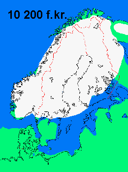
http://www.tacitus.nu/historical-atlas/ ... inland.htm
(Finlandia)
Just for a pictorial reference, here is a main-stream view of how 12,000 years of drainage may have produced some
potholes.
http://www.tacitus.nu/historical-atlas/ ... ce_age.htm
Another thought: a Skandinavian land mass rebound, as ice cover recedes, could cause more than a few minor earthquakes ?
Respectfully,
seasmith
http://www.tacitus.nu/historical-atlas/ ... inland.htm
(Finlandia)
-
finno
- Posts: 31
- Joined: Wed Jul 18, 2012 9:18 am
Re: Questioning the Ice Ages
Yes. Rebound maked that massive earthquakes. There was about 58 earthquake at 9 richter in short time. it wasnt mammoths day. but im not sore, did glacial that ground first down. today ground goes down in denmark and holland, and im very sore, there is not now iceage. actually, outer core can moves down and up like waves, but what moving it? Global catastrophe what happened 10 000 year ago?seasmith wrote:Hello finno,
Another thought: a Skandinavian land mass rebound, as ice cover recedes, could cause more than a few minor earthquakes ?)
and why in scotland is rebound. Theory say, there ended ice age 40 000 years before like in scandinavia or hudsonbay? still its rebound is fast?
but lets talk about again potholes.
its very intresting how peoples round the world can get same conclusions. Parkkunen, when he talked in his book from electric tornadoes how they been burned potholes and smash rocks etc, that book been printed 1984. today when I read that book, its not very far from Dwardu Cardonas Flare Star. Of course, Cardona is many lightyears smarter…
but I not been so much intresting from glacial times, like potholes. Professionals says, potholes born when glacial moving. I know its only theory, because you can found potholes from places, where never been iceage. In here is picture from pothole in Sahara:
http://www.tradebit.com/filedetail.php/ ... ver-bed-el
But can water do that? Who knows. I am pretty sore, potholes burning from plasma discharge – like meteor craters. How proof it?
I know how radical this idea is, but when check photos from Mars caves, they are circles – like potholes. Can there be potholes in Mars? If does, no one water cant explain it. This is hole, not cave:
http://apod.nasa.gov/apod/ap120718.html
-
GaryN
- Posts: 2668
- Joined: Tue Apr 01, 2008 8:18 pm
- Location: Sooke, BC, Canada
Re: Questioning the Ice Ages
Yes, I have read the standard model conjecture, and to me it is similar to how the cosmologists use extremely long time lines to explain their models. The unwillingness by geologists to consider recent catastrophic, ultra-energetic events leaves them no alternative to the millions of years scenario.About 100 million years ago,...(from http://www.crd.bc.ca/watersheds/protect ... toryVI.htm )
@ seasmith
I see them not being smoothed into boulders by a rock tumbling mechanism, but by being formed as molten blobs in the pinch region of a plasma tornado that cut the canyons and pulled rock off the surface. There are also slabs and angular shaped blocks with flat surfaces lying in the valleys and canyons which I would say are from electrical repulsive forces cleaving the rock along existing weaknesses. A mix of plasma and strong, probably pulsed electric fields is no doubt going to produce many mixed effects. Where large flat slabs occur, you need only look up to see the vertical faces they came from, and very little weathering or erosion is evident on those faces, so probably they are much more recent events than believed. I'm going to do some cross-section sketches of some of the river beds, canyons, etc around my area, as it is difficult to get a photo that conveys the full scenario I have in mind.Something smoothed them into boulders, because granite breaks off in ragged chunks....
This is another process that I am unable to find convincing evidence of. Yes, there is upward movement of the surface in some areas, but sinking or no movement in others. I looked at the Snowball Earth model too, and other papers that assure me they know the sea level, ice cover, temperatures, position of the continents, height of the mountains, everything about the Earth it seems, over tens and hundreds of thousands or even millions of years, but again, to me, it seems like models built on models based on assumptions that can not, due to the time scales involved, ever be proven. I'm much more inclined to believe the legends of the native American Indians that talk of the Gods throwing lightning bolts, and mountains rising and melting over periods of hours, than I am in much of conventional geology. Even the idea of a squidgy surface that can be deformed by the weight of the assumed miles of ice cover can not be proven to my satisfaction, and my model of the Earth as a multi-layer ceramic capacitor, with electrical currents between layers and resistance heating being responsible for magma creation, and piezoelectric forces or rock crystal reconfiguration causing earthquakes, can not be positively ruled out. To many unknown unknowns.Rebound
In order to change an existing paradigm you do not struggle to try and change the problematic model. You create a new model and make the old one obsolete. -Buckminster Fuller
-
webolife

- Posts: 2539
- Joined: Mon Mar 17, 2008 2:01 pm
- Location: Seattle
Re: Questioning the Ice Ages
"...unknown unknowns", as opposed to known unknowns 
There is much in this cosmos that we know that we don't know, and much more we don't know that we don't know.
I agree with Gary that even a cursory study of actual field evidence feeds much skepticism toward the standard model of geology, when viewed from an unbiased or at least open-minded perspective.
I agree with moses that there was no ice on Earth before the "ice age", as virtually all sedimentary fossil evidences infer a tropical global climate. I agree also that shifting orbital dynamics or tidal issues involving an interplanetary or cometary event were responsible for a series of flooding episodes and later rounds of glacial advance-retreats; I think that these occurred all within an initial period spanning months, then a few centuries, and tapering off until the current stage of polar glaciation, a truly catastrophic series of events, not the uniformitarian presumptions.
I think that migration of the North American natives occurred within a couple centuries after the initial meltback of the glaciation we refer to as the Ice Age. Some of these early natives may have heard 2nd or 3rd hand testimony describing that flood cataclysm preceded the glaciation. It is difficult to know if any humans were situated close enough to the arctic to see the onset of the continental glaciation... I favor that there was a small population living in the Mesopotamian region when this occurred with perhaps some migration into Africa, and that ice was first encountered by some migrants in their northeastern trek toward the Bering land[ice] bridge.
Some significant additional factors supporting and episode of continental glaciation are:
1. various indications and scales of scouring, including parallel striations on boulders, which Gary may have seen on south Vancouver Island, also along the coastline of Washington and some of the San Juan islands
2. glacial deposits, including till and ancient moraines, etc.
3. fast frozen mammoths with undigested identifiable tropical plants in their stomachs
4. current continental glaciation with a [continuous?] historical connection to the recent "Pleistocene" events.
Truth extends beyond the border of self-limiting science. Free discourse among opposing viewpoints draws the open-minded away from the darkness of inevitable bias and nearer to the light of universal reality.
-
GaryN
- Posts: 2668
- Joined: Tue Apr 01, 2008 8:18 pm
- Location: Sooke, BC, Canada
Re: Questioning the Ice Ages
@webo
http://www.youtube.com/watch?v=_RpSv3HjpEw
2. Well we certainly see till and moraines in some valleys, but not enough to account for the missing volume of material. Surface erosion in a plasma cut trench, IMO.
3. Caught in a cold, dense ion stream.
4. The present glaciers are performing minor scouring in the plasma cut trenches. Pleistocene is, perhaps, a fallacy created to affirm the speculative time line of conventional geology.
As you see, I'm not straddling the fence here, both feet are firmly on the side of full electric/plasma processes, globally.
While doing some searching, I did come upon this page, maybe by a TB member as it does reference a TB Picture of the Day.
http://www.freerepublic.com/focus/chat/ ... plies?c=37
And on the earthquake subject:
http://www.tandfonline.com/doi/pdf/10.1 ... 5.10422119
It is also known that an electric field "can have a pronounced effect on the crystallisation of phase-change materials". Electrically induced earthquakes then?
All credit goes to Rumsfeld for that quote!"...unknown unknowns", as opposed to known unknowns
http://www.youtube.com/watch?v=_RpSv3HjpEw
1. On the contrary, any markings I have seen do not look like glacial scars, and a search on the 'net produces only one or two results. What other people see as glacial scarring may just as well be from surface plasma flows, or an electric wind. One long and wide shallow trough I have seen at very low tide at Point No Point, on the Island, was explained as being from a huge boulder being pushed down the coast, but the fact that the trough is so even in depth and width for as far as is observable raises doubts in my mind. For anyone who has never considered an alternative to glacial scarring, it can only be glacial.Some significant additional factors supporting and episode of continental glaciation are:
1. various indications and scales of scouring, including parallel striations on boulders, which Gary may have seen on south Vancouver Island, also along the coastline of Washington and some of the San Juan islands
2. glacial deposits, including till and ancient moraines, etc.
3. fast frozen mammoths with undigested identifiable tropical plants in their stomachs
4. current continental glaciation with a [continuous?] historical connection to the recent "Pleistocene" events.
2. Well we certainly see till and moraines in some valleys, but not enough to account for the missing volume of material. Surface erosion in a plasma cut trench, IMO.
3. Caught in a cold, dense ion stream.
4. The present glaciers are performing minor scouring in the plasma cut trenches. Pleistocene is, perhaps, a fallacy created to affirm the speculative time line of conventional geology.
As you see, I'm not straddling the fence here, both feet are firmly on the side of full electric/plasma processes, globally.
While doing some searching, I did come upon this page, maybe by a TB member as it does reference a TB Picture of the Day.
http://www.freerepublic.com/focus/chat/ ... plies?c=37
And on the earthquake subject:
(pdf)Phase change and earthquakes.
http://www.tandfonline.com/doi/pdf/10.1 ... 5.10422119
It is also known that an electric field "can have a pronounced effect on the crystallisation of phase-change materials". Electrically induced earthquakes then?
In order to change an existing paradigm you do not struggle to try and change the problematic model. You create a new model and make the old one obsolete. -Buckminster Fuller
-
webolife
- Posts: 2539
- Joined: Mon Mar 17, 2008 2:01 pm
- Location: Seattle
Re: Questioning the Ice Ages
Gary,
You are not the only one who has accused me of "fence straddling"!!!
But I'm no mugwump here with respect to my belief in interplanetary-involved catastrophic earth history...
I accept stratum labels as convenient markers of strata bearing identifiable evidence for worldwide/global catastrophic action. Thus the Cambrian "explosion", the Permian extinctions and the K/T event, among others, mark zones that document massive destructive worldwide flooding. The "Pleistocene" label for me basically means "prehistoric", and I care not for the tens, hundreds, thousands, ten-thousands, or hundred-thousands of millenia that are attached to these strata by uniformitarian presumptions.
I don't buy the Saturn theory yet, and I have serious questions about the nature of EDM as a primary crust deforming process. Attributing effects to speculative causes unseen is always a risky business, albeit it helps to drive wedges in the stumps of old paradigms.
I believe in the commitment and integrity of the EU proponents, and wish to see their premises supported by robust verifiable evidence. I do not see myself as a leader in EU, but neither do I see myself as a detractor... I am here to pose questions and challenge propositions built on shaky foundations. I search for areas in which opposing dogma agree, and point out inconsistencies when I see them.I learn much every time I visit this forum. I have my own ideas of course, and occasionally insert my own paradigm-dashing postulates. Ideas I have held for decades have been greatly modified, and sometimes abandoned through dialogue with my friends [and opponents?] here.
With regard to this thread, I have investigated so called "glacial" evidence throughout Washington, comparing parallel grooving on the walls of glaciers on Mount Rainier with those found on the coast along Chuckanut Drive, eg. at Larrabee Park. Tills seen in road cuts in the Cascades compare readily with those found in the San Juans, as wells as in deposits in the moraines of the Nisqually glacier on Rainier. Now just because an active glacier is producing a deposit that is very similar to those seen in Puget Sound doesn't prove that the Sound was glacier cut, but commonality of effect certainly lends support to the proposition of a common cause, n'est-ce pas?
Truth extends beyond the border of self-limiting science. Free discourse among opposing viewpoints draws the open-minded away from the darkness of inevitable bias and nearer to the light of universal reality.
-
rjhuntington
- Posts: 84
- Joined: Thu Mar 18, 2010 7:24 am
Re: Questioning the Ice Ages
Your English is fino, finno, and rather charming (and much better than my Finnish). I can hear you speak as I read your text. Thank you for the interesting information you brought.finno wrote:...so sad because my english is what is.
Who is online
Users browsing this forum: No registered users and 0 guests